Navionics+™ NSSA005L - Chile, Argentina and Easter Island - Marine Chart
Get the world’s No. 1 choice in the marine mapping with the best, most up-to-date Navionics®+ cartography on your compatible chartplotter.
Featuring vibrant colors, a streamlined interface and combined coastal/inland content with a popular Navionics® style color palette, Garmin Navionics+ cartography makes it easy to plot your course. Multiple shading options aid in shallow water navigation and make it easy to highlight a target depth range for the best fishing spots. Fully customizable with various chart layers, overlay combinations and up to 10 color-shaded target depth ranges to scope out the best fishing spots.
When you purchase a new Garmin Navionics+ or Garmin Navionics Vision+ cartography product, a one-year subscription is included.
Chart Code - NSSA005L
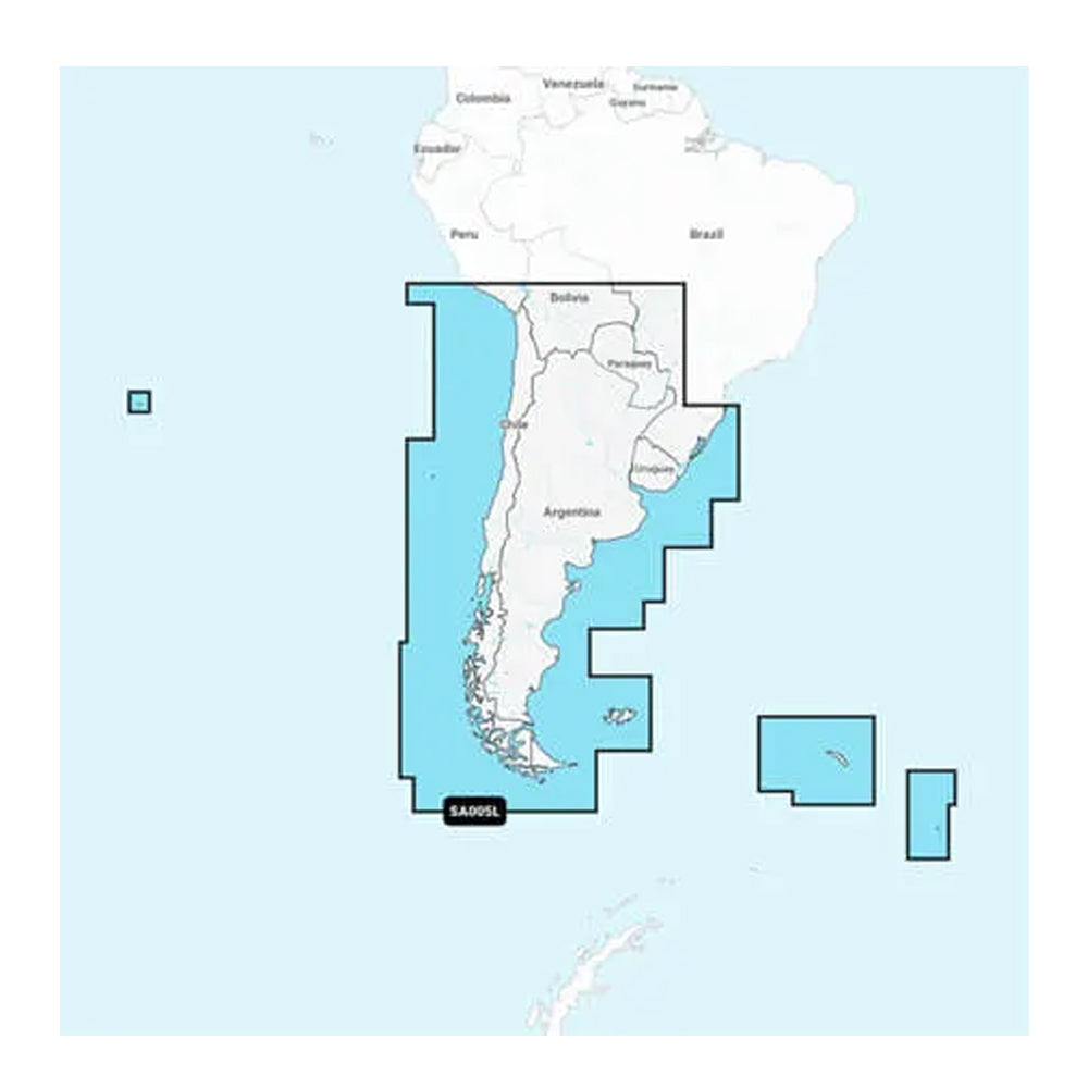
Coverage Area:
Coastal coverage of South America from Arica, Chile to Rio Grande, Brazil. Coverage includes Easter Island, Cape Horn, the Falkland Islands/Islas Malvinas, the South Georgia Islands, the South Sandwich Islands and the Rio de la Plata.
Features:
All-in-one Map Solution - Access detail-rich mapping of coastal features, lakes, rivers and more. Integrated Garmin and Navionics® content offers coverage for boaters worldwide.
Daily Chart Updates - Charts are constantly being enhanced with new and amended content — as many as 5,000 updates are made every day. The one-year included subscription gives you access to daily chart updates via the ActiveCaptain app.
Auto Guidance+ Technology - Combining the best of Garmin and Navionics automatic routing features, built-in Auto Guidance+ technology1 gives you a suggested dock-to-dock path to follow through channels, inlets, marina entrances and more.
Depth Range Shading - High-resolution depth range shading lets you select up to 10 color-shaded options and view your designated target depths at a glance.
Up to 1' Contours - For improved fishing and navigation, up to 1' contours provide a clear depiction of bottom structure for improved fishing charts and enhanced detail in swamps, canals, harbors, marinas and more.
Shallow Water Shading - To give a clear picture of shallow waters to avoid, this feature allows for shading at a user-defined depth.
ActiveCaptain Community - Community-sourced content provides useful POIs, such as marinas, anchorages, hazards, businesses and more. Get recommendations from boaters with firsthand experience of the local environment.
Compatibility:
Check the compatibility of Garmin Navionics+ content and features with your GPS chartplotter.
Technical Specifications:
Format - MicroSD/SD Card
In the Box:
SD/MSD Card
1Auto Guidance+ is for planning purposes only and does not replace safe navigation operations
At Adrenalux, we’re dedicated to offering the best prices online for all of our products. If you find a lower price from another online retailer, let us know, and we’ll beat it—guaranteed. We want you to shop with confidence, knowing you're getting the best possible deal.
Our 100% Price Match Guarantee includes the following conditions:
Promotions like rebates or "buy one, get one free" offers are not eligible.
The competing website cannot be a discount or auction site (e.g., eBay).
The competitor must be an Authorized Retailer of the product you’ve purchased.
The price match will account for the item price, taxes, and shipping fees.
Price matches do not apply to exchanges or replacements.
Please Note: Some exclusions may apply.
Payment & Security
Your payment information is processed securely. We do not store credit card details nor have access to your credit card information.